Back مجيدو Arabic مجيدو ARZ Мегидо Bulgarian Megido BS Meguidó Catalan Tel Megiddo CEB Megido Czech Megiddo German Μεγιδδώ Greek Megido Esperanto
תל מגידו | |
 An aerial view of Tel Megiddo | |
| Alternative name | Tell el-Muteselim (Arabic) |
|---|---|
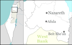
| Location | northern end of Wadi Ara toward Jezreel Valley, Israel |
| Region | Levant |
| Coordinates | 32°35′07″N 35°11′04″E / 32.58528°N 35.18444°E |
| Type | Settlement |
| Part of | Canaanite city-state (Early to Middle Bronze Age) Egyptian empire (Late Bronze Age) Kingdom of Israel (Iron Age II) |
| History | |
| Abandoned | 350 BCE |
| Site notes | |
| Public access | yes (national park) |
| Website | Tel Megiddo National Park website The Megiddo Expedition website |
| Official name | Biblical Tells – Megiddo, Hazor, Beer Sheba |
| Type | Cultural |
| Criteria | ii, iii, iv, vi |
| Designated | 2005 (29th session) |
| Reference no. | 1108 |
| Region | Asia-Pacific |
Tel Megiddo (from Hebrew: תל מגידו), Arabic: Tell el-Muteselim, is the site of the ancient city of Megiddo (/məˈɡɪdoʊ/; Greek: Μεγιδδώ), the remains of which form a tell or archaeological mound, situated in northern Israel at the western edge of the Jezreel Valley about 30 kilometres (19 mi) southeast of Haifa near the depopulated Palestinian town of Lajjun and subsequently Kibbutz Megiddo. Megiddo is known for its historical, geographical, and theological importance, especially under its Greek name Armageddon. During the Bronze Age, Megiddo was an important Canaanite city-state. During the Iron Age, it was a royal city in the Kingdom of Israel.
Megiddo's strategic location at the northern end of the defile of the Wadi Ara, which acts as a pass through the Carmel Ridge, and its position overlooking the rich Jezreel Valley from the west gave it much of its importance.
Excavations have unearthed 20 strata of ruins since the Neolithic phase, indicating a long settlement period.[1] The site is protected as Megiddo National Park and is a World Heritage Site.[2]
- ^ Cite error: The named reference
Cline, Ericwas invoked but never defined (see the help page). - ^ "UNESCO World Heritage Centre - Document - Tel Megiddo National Park".


