Back ليك رونكونكوما (نيويورك) Arabic لاك رونكونكوما, نيويورك ARZ لیک رونکونکوما، نیویورک AZB Lake Ronkonkoma Catalan Lake Ronkonkoma (lungsod) CEB Lake Ronkonkoma Spanish Lake Ronkonkoma (New York) Basque لیک رونکونکوما (نیویورک) Persian Lake Ronkonkoma (New York) French لیک رونکونکاما (نيۊیؤرک) GLK
This article needs additional citations for verification. (February 2012) |
Lake Ronkonkoma, New York | |
|---|---|
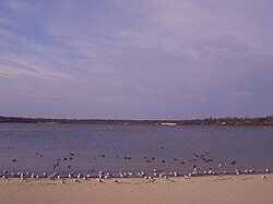
 Lake Ronkonkoma, the lake for which the community was named. | |
 U.S. Census map | |
| Coordinates: 40°49′47″N 73°6′47″W / 40.82972°N 73.11306°W | |
| Country | |
| State | |
| County | Suffolk |
| Town | Brookhaven Islip Smithtown |
| Named after | Lake Ronkonkoma |
| Area | |
• Total | 4.54 sq mi (11.76 km2) |
| • Land | 4.54 sq mi (11.75 km2) |
| • Water | 0.00 sq mi (0.01 km2) |
| Elevation | 72 ft (22 m) |
| Population (2020) | |
• Total | 18,619 |
| • Density | 4,104.72/sq mi (1,584.67/km2) |
| Time zone | UTC−05:00 (Eastern Time Zone) |
| • Summer (DST) | UTC−04:00 |
| ZIP Code | 11779 |
| Area code(s) | 631, 934 |
| FIPS code | 36-40838 |
| GNIS feature ID | 0954936 |
Lake Ronkonkoma is a hamlet and census-designated place (CDP) in Suffolk County, on Long Island, New York, United States. The population was 18,619 at the time of the 2020 census.[2]
Located on the north and east sides of the eponymous lake, Lake Ronkonkoma is mainly located in the Town of Brookhaven, with smaller sections being located within the Town of Smithtown and the Town of Islip.
- ^ "ArcGIS REST Services Directory". United States Census Bureau. Retrieved September 20, 2022.
- ^ "Geographic Identifiers: 2010 Demographic Profile Data (G001): Lake Ronkonkoma CDP, New York". U.S. Census Bureau, American Factfinder. Archived from the original on February 12, 2020. Retrieved January 2, 2013.

